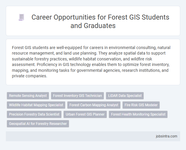
Forest GIS students are well-equipped for careers in environmental consulting, natural resource management, and land use planning. They analyze spatial data to support sustainable forestry practices, wildlife habitat conservation, and wildfire risk assessment. Proficiency in GIS technology enables them to optimize forest inventory, mapping, and monitoring tasks for governmental agencies, research institutions, and private companies.
Remote Sensing Analyst
Remote Sensing Analysts in forestry specialize in interpreting satellite and aerial imagery to monitor forest health, assess biomass, and detect changes in vegetation over time. They utilize GIS software and remote sensing technologies to support sustainable forest management and conservation efforts. These professionals play a crucial role in providing accurate spatial data for wildfire prevention, habitat analysis, and resource planning.
Forest Inventory GIS Technician
Forest Inventory GIS Technicians play a critical role in collecting, analyzing, and managing spatial data to monitor forest resources and support sustainable management practices. They use Geographic Information Systems (GIS) to map forest attributes, assess tree health, and track changes over time, enabling accurate inventory and decision-making. Proficiency in remote sensing, data analysis, and field data collection techniques is essential for success in this position.
LiDAR Data Specialist
LiDAR Data Specialists in the forest GIS field analyze high-resolution spatial data to create detailed maps and 3D models of forest terrains. They process LiDAR point clouds to assess forest structure, monitor biomass, and support sustainable forest management practices. Proficiency in GIS software and remote sensing technologies is essential for transforming raw LiDAR data into actionable forestry insights.
Wildlife Habitat Mapping Specialist
Wildlife Habitat Mapping Specialists use advanced GIS technology to analyze and visualize animal habitats, helping conservationists make informed decisions. You can work with government agencies, environmental organizations, or research institutions to monitor biodiversity and support habitat restoration projects. Expertise in spatial data analysis and ecological principles is essential for success in this role.
Forest Carbon Mapping Analyst
Forest Carbon Mapping Analysts specialize in utilizing GIS technology to assess and monitor carbon stocks in forested ecosystems. They analyze satellite imagery and spatial data to estimate carbon sequestration, supporting climate change mitigation efforts. Their expertise aids in forest management, conservation planning, and reporting for carbon credit programs.
Fire Risk GIS Modeler
Forest GIS students can excel as Fire Risk GIS Modelers by applying spatial analysis to assess wildfire hazards and create predictive models. Utilizing satellite imagery and terrain data, you help land managers prioritize areas for controlled burns and emergency response planning. Expertise in GIS software and fire ecology ensures accurate risk mapping that supports effective forest protection strategies.
Precision Forestry Data Scientist
Precision Forestry Data Scientists analyze spatial data to optimize forest management and enhance sustainable practices. Your expertise in GIS and remote sensing enables accurate monitoring of forest health, growth patterns, and resource allocation. This role supports decision-making by integrating advanced data analytics with ecological insights.
Urban Forest GIS Planner
An Urban Forest GIS Planner analyzes spatial data to manage and improve urban green spaces efficiently. This role involves using GIS technology to map tree populations, assess environmental impacts, and plan sustainable urban forestry projects. Your expertise helps cities enhance urban canopy cover, promote biodiversity, and support community well-being.
Forest Health Monitoring Specialist
Forest Health Monitoring Specialists use GIS technology to assess and track the condition of forest ecosystems, identifying stress factors such as disease, pests, and environmental changes. Your skills in spatial analysis and remote sensing enable precise mapping and monitoring, supporting sustainable forest management and conservation efforts. These specialists collaborate with environmental agencies to provide critical data that informs decision-making and policy development.
Good to know: jobs for Forest GIS students
Overview of Forest GIS Careers
Forest GIS jobs combine geographic information system technology with forestry science to analyze and manage forest resources effectively. Careers include roles such as GIS analyst, forest inventory specialist, and spatial data technician, focusing on mapping, data analysis, and natural resource planning. Your skills in GIS software and forest ecology prepare you for impacting conservation and sustainable forest management projects worldwide.
Key Skills Required for Forest GIS Roles
| Job Role | Key Skills Required |
|---|---|
| Forest GIS Analyst | Proficiency in GIS software (ArcGIS, QGIS), spatial data analysis, remote sensing, forest inventory techniques, data management, map creation, and interpretation. |
| Remote Sensing Specialist | Expertise in satellite image interpretation, UAV data processing, image classification, change detection, integration of remote sensing with GIS, and geospatial data analysis. |
| Forest Resource Manager | Skills in GIS-based forest resource assessments, plotting forest boundaries, habitat analysis, use of forest management software, and ability to utilize GIS for sustainable forestry practices. |
| Environmental Consultant - Forestry | Competency in environmental impact assessments using GIS, spatial modeling, report generation, regulatory compliance, and strong analytical skills related to forest ecosystems. |
| GIS Technician - Forestry | Technical skills in data input, map production, quality control of spatial data, database maintenance, and basic spatial analysis relevant to forestry projects. |
| Forest Conservation Planner | Capabilities in habitat suitability modeling, landscape ecology, spatial planning, biodiversity mapping, and collaborative GIS project workflows aimed at forest conservation. |
| Researcher in Forest GIS | Strong analytical abilities, proficiency in advanced geospatial analysis, programming skills (Python, R), data visualization, and experience with forest ecosystem studies. |
| Wildfire Analyst | Expertise in fire behavior modeling using GIS, risk assessment, use of spatial data for fire prevention strategies, and integration of weather and topographic data in GIS platforms. |
| GIS Project Manager - Forestry | Leadership skills, project planning, budgeting, stakeholder communication, advanced GIS knowledge, and monitoring of forest-related GIS projects. |
| Forestry Data Scientist | Experience in big data analytics, machine learning applications in GIS, statistical analysis, spatial data mining, and capability to interpret complex forestry datasets. |
Entry-Level Positions for Forestry GIS Graduates
Entry-level positions for Forestry GIS graduates offer valuable opportunities to apply spatial analysis skills in natural resource management. These roles help build a foundation in forest data collection, mapping, and environmental monitoring.
- GIS Technician - Supports forest management teams by creating and maintaining spatial databases for forest inventory and land use planning.
- Forest Data Analyst - Analyzes geographic data to assist in identifying patterns related to forest health, wildfire risk, and biodiversity conservation.
- Environmental GIS Intern - Gains practical experience by integrating remote sensing data with GIS tools for ecological assessments and habitat mapping.
Advanced Career Paths in Forest GIS
Forest GIS students have access to advanced career paths that involve spatial analysis, ecosystem management, and resource planning. Roles such as Forest GIS Analyst, Remote Sensing Specialist, and Natural Resource Planner require expertise in mapping forest health and managing timber resources.
You can work with government agencies, environmental consulting firms, or forestry companies to develop data-driven strategies for conservation and sustainable forest use. Mastery of GIS software, spatial data modeling, and geospatial technologies positions you for leadership in forestry management and research.
Employers and Organizations Hiring Forest GIS Professionals
Forest GIS students have diverse career opportunities in forestry-related sectors. Employers value skills in spatial analysis and environmental data management for sustainable forest management.
- Government Agencies - Agencies like the U.S. Forest Service and Natural Resources departments hire GIS professionals to monitor forest health and plan resource management.
- Environmental Consulting Firms - These firms employ Forest GIS experts to conduct impact assessments and support conservation projects using geospatial data.
- Nonprofit Organizations - Conservation groups such as The Nature Conservancy seek Forest GIS specialists for habitat mapping and environmental advocacy.
Your GIS expertise enhances decision-making processes across forestry and environmental management fields.
Certifications and Further Education for Forest GIS Careers
Forest GIS students have promising career opportunities in forestry management, environmental consulting, and natural resource planning. Certifications and further education enhance your qualifications and open doors to specialized roles in this field.
- GIS Certification - Professional GIS certifications validate your technical skills and increase job competitiveness.
- Advanced Degrees - Pursuing a master's or specialized forestry degree deepens your expertise and expands career options.
- Remote Sensing Training - Additional courses in remote sensing improve your ability to analyze forest data for precise decision-making.
Future Trends and Emerging Opportunities in Forest GIS
Forest GIS students have growing career opportunities in natural resource management, environmental consulting, and conservation planning. Job roles include GIS Analyst, Remote Sensing Specialist, and Forest Data Manager, reflecting increasing demand for spatial data expertise in forestry.
Future trends highlight the integration of artificial intelligence and drone technology to enhance forest monitoring and wildfire management. Emerging opportunities involve precision forestry, carbon sequestration mapping, and climate change impact modeling. Your skills in GIS software, spatial analysis, and data interpretation will be critical in advancing sustainable forest management practices.